Maps & Data
The Columbia River Gorge Commission works with partner agencies and organizations to develop and maintain spatial data to support county planning departments and the public in evaluating development applications with accuracy and transparency.
In addition to the static Management Plan maps below, our Mapping and Spatial Data Hub provides access to interactive online maps and select downloadable data.
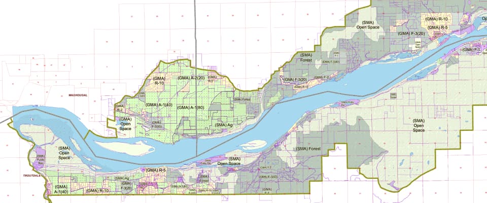
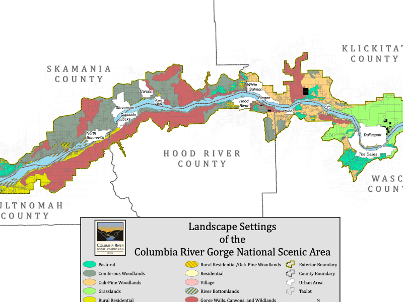
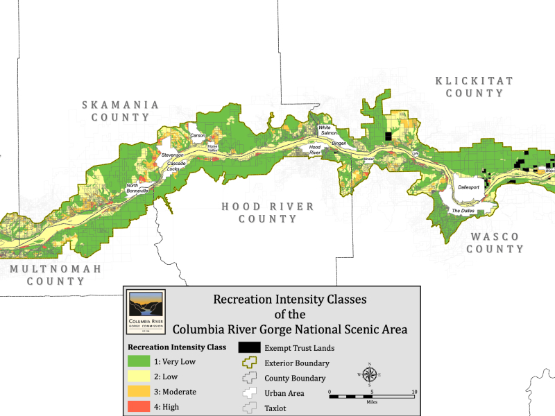
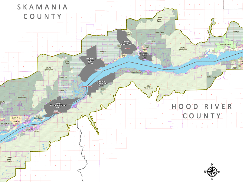
Management Plan Maps
The Management Plan describes three foundational maps:
The Columbia River Gorge Commission data, information, and maps are provided “as is” without warranty or any representation of accuracy, timeliness, or completeness. This information is intended for general planning purposes and is not intended for site specific planning or analysis. Original data was compiled from various sources and should be verified with those sources. Spatial information may not meet National Map Accuracy Standards. The user acknowledges and accepts all limitations, including the fact that the data, information, and maps are dynamic and in a constant state of maintenance, correction, and update.