About Us
The Columbia River Gorge Commission is a bi-state public agency that includes staff and commissioners. We work with the USDA Forest Service to help care for the non-federal lands in the Columbia River Gorge National Scenic Area (NSA).
These lands have been home to Indigenous peoples since time immemorial, including the Confederated Tribes of Warm Springs, the Confederated Tribes and Bands of the Yakama Nation, the Confederated Tribes of the Umatilla Indian Reservation, and the Nez Perce Tribe. We honor their connection to this place and are committed to working together to continue to protect these lands and waters through understanding, science, community, and policy.
We partner with the six counties in the NSA to guide land use decisions, support local rules, and encourage economic development while preserving the beauty, health, and character of this special place.
About the National Scenic Area
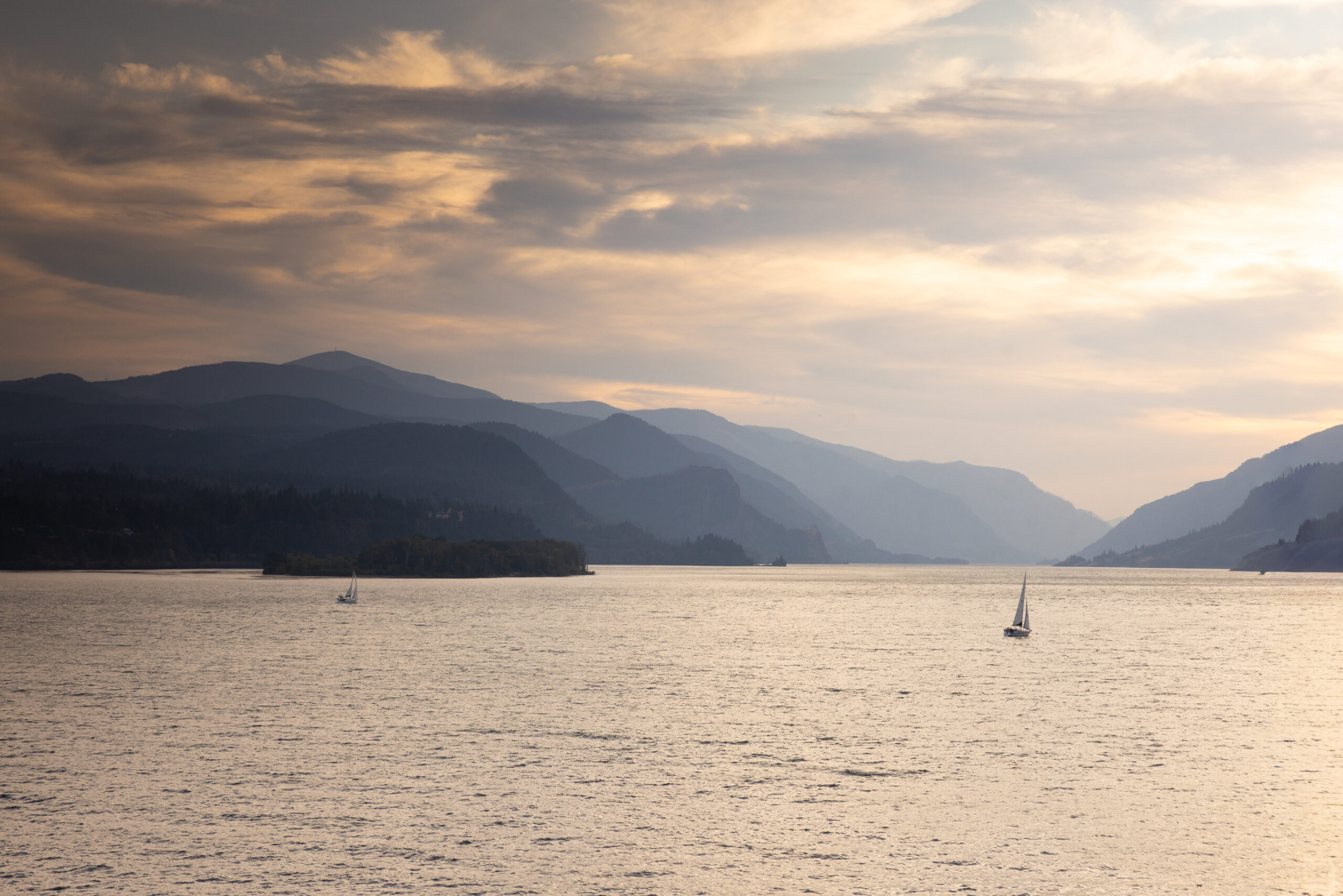
The National Scenic Area stretches 85 miles across six counties. Three of the counties are in Oregon and three are in Washington.
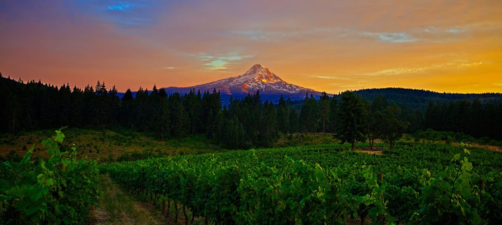
Carved by the path of the mighty Columbia River as it flows from Canada to the Pacific Ocean, the Columbia River Gorge (Gorge) is a dramatic canyon that was shaped by lava flows from ancient volcanoes and massive floods.
As the only sea-level route through the Cascades to the ocean, the Gorge is full of amazing contrasts. The lush western Gorge, with 75 inches of annual rainfall, is home to misty forests and more waterfalls than anywhere else in the country. In contrast, the eastern Gorge is much drier, with less than 15 inches of rain each year. There you’ll find rocky cliffs, rolling hills, and grasslands.
The NSA is also home to about 75,000 people. Many people work in jobs connected to farming, tourism, outdoor recreation, and other local businesses.
The NSA was created in 1986 by a federal law. The law calls for us to protect the Gorge’s scenery, nature, and cultural and recreational resources while also helping local communities and economies thrive. The NSA includes 292,500 acres of protected land on both sides of the Columbia River. It stretches from the edge of Portland and Vancouver in the west to the drier regions of Wasco and Klickitat counties in the east.
How the National Scenic Area is Managed
The Columbia River Gorge National Scenic Area includes three types of areas: Special Management Areas, General Management Area, and Urban Areas.
Special Management Areas cover approximately 114,600 acres. These areas contain some of the Gorge’s most sensitive and protected natural and cultural resources.
The General Management Area is the largest, with about 149,400 acres. It includes many different types of land, such as farms, forests, grazing lands, residential areas, and public recreation areas.
Development on private land is managed by five of the six counties in the National Scenic Area, and the Gorge Commission staff manages development in Klickitat County, Washington. Development on federal lands is reviewed by the USDA Forest Service, Columbia River Gorge National Scenic Area Office.
Urban Areas are towns and cities inside the National Scenic Area that are not subject to NSA rules. There are 13 of them:
- In Oregon: Cascade Locks, Hood River, Mosier, and The Dalles.
- In Washington: North Bonneville, Stevenson, Carson, Home Valley, White Salmon, Bingen, Lyle, Dallesport, and Wishram.
- Tribal lands held in trust by the Bureau of Indian Affairs are also exempt from National Scenic Area law.